Doole, Texas (76836)

HISTORICAL SUMMARY by Jonathan Guajardo

The former ranching community of Doole, Texas sits 28 miles Northwest of Brady at the intersection of FM 503 and FM 765. Settled by the Gansel Family, Doole was originally known as the town of Gansel during its early days. Unfortunately, their request for a post office under that name was denied in 1911. Due to this setback, the townspeople renamed their community Doole, after Brady’s postmaster, David Doole, who had been advising them on the name change.

By 1914, Doole maintained a population of 25, and by the 1940s, the town maintained a steady population of 250 and held within its city limits: a school, a church, and ten businesses, including a diner, a grocery store, and a mechanic’s shop. The population declined to 40 in the 1960s and, despite a small spike in the 70s, continued to decline until it finally evolved into the ghost town that it is today.

Note: Doole is the only ghost town we’ve visited that still maintains its own zip code (76836).

STRUCTURAL ANALYSIS by William Timmerman

The town of Doole, TX is still functioning, although only a handful of families still live there. They live among the ruins of this town that was founded in the dust-bowl era and was mostly disbanded by the 1970s. I will rate the school and the houses separately since they are from different eras and are built with different construction methods.

HIGH SCHOOL

Characteristics: Doole’s high school is set atop a hill on the northwest corner of the intersection of FM765 and FM503 [map 1]. The school itself has been demolished, and a small community center has taken its place. However, there is still an extensive system of walls from the 1930s that are still in fairly good condition. These waist-high stone boundaries form the outline of the school as well as the schoolyard. The stadium seats, built into the east face of hill, are also a notable feature.

Structural Integrity (4/10): The stadium seats are partially collapsed and unstable. Made out of concrete slabs and rock, they have cracked and shifted in the dry shrink-swell clay soil. The walls are 80% intact with some sections missing or inaccessible due to overgrowth.

Vandalism (1/10): There is no vandalism or graffiti present.

RESIDENCES

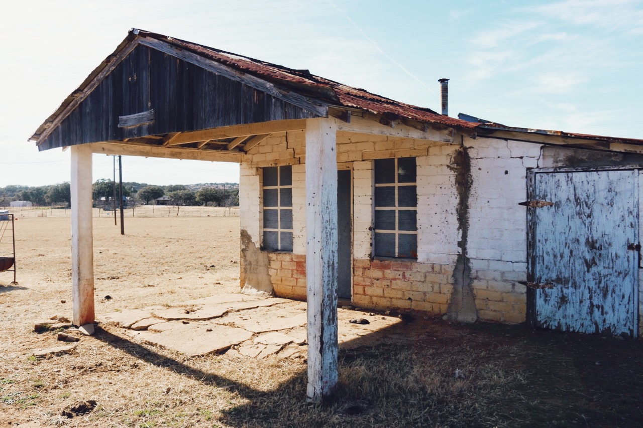
Characteristics: The rest of the homes are from the 1950s-1970s. They are in remarkable shape considering the way they have decayed in place, with many of the original furnishings intact.

Residential Structural Integrity (6/10): Many of the houses suffer from mold, termite and water damage. Floorboards and wallpaper are damaged. In one of the houses the fireplace chimney collapsed. Most of the doors are not preset. Be warned that there are vibrant communities of bees that hang inside the houses.

Residential Vandalism (1/10): There is no vandalism or graffiti present.
Aldridge, Texas

Nestled deep within the piney woods of the Angelina National Forest sits one of the most intact of all of East Texas’ numerous ghost towns. Founded as a logging community in 1898 by Hal Aldridge, he established the town deep within the forests of Jasper County, with the intention of taking advantage of the area’s plentiful woods and pristine river.

At one time, this community reached a population of just over 1,000 citizens and contained a commissary, a hotel, a depot, a dispensary, 2 churches, 2 schools, and the houses of 200 tenants. However, after some controversial disputes with labor organizers, a growing number of increasingly disgruntled workers, and an unfortunate fire in 1911 which almost destroyed the entirety of the mill structure, the future of the town seemed bleak.

After mortgaging the remainder of the mill to John H. Kirby, he began the construction of several large concrete rooms to house the engines, boilers, flywheels and dry kilns. Designed in accordance with the requirements for fire insurance, he hoped to safeguard against any major future financial loss.

Another fire scare occurred in 1914, and a year later the entire mill burned to the ground. Discouraged, Hal Aldridge packed up and moved his logging dreams to El Paso, selling the site to Beaumont’s J. Frank Keith who operated a smaller 40,000-foot sawmill for 18 months before selling to the Kirby Lumber Company. A large majority of the city left with Hal, and the looming shadow of a future ghost town crept eerily over the remaining residents.

The last known sawmill on the property burned down in 1918 and in 1925 the railroad tracks which used to ship logs out of Aldridge were torn up. The town was abandoned the same year and slowly began to be reclaimed by its surroundings. Today, it sits as a desolate remnant of a time long past and a troubled establishment which never found its way out of the thick pines of East Texas.

Benton, Texas

Founded in 1876, Benton may have been named for Missouri senator, Thomas Hart Benton or Samuel L. Benton, a hero of the Texas Revolution. By 1904, Benton held within its city limits a Masonic lodge, a newspaper, a school (the Benton City Institute), one general store, a blacksmith shop, a gristmill-gin, three churches, and several ranching operations. Bypassed by the International-Great Northern Railroad in 1881, the town spent the majority of its existence struggling to stay afloat. In 1919, the high school consolidated with the Lytle school district and in 1934 the elementary school closed. Eventually, all that would remain to mark the site of a once-great town would be the abandoned Benton City Institute, located within the present-day city of Lytle, Texas.


ANALYSIS OF THE RUINS OF THE BENTON CITY INSTITUTE 

Approximate Location: (29*12′11″, 98*46′12″)

by William Timmerman

CHARACTERISTICS:

Fashioned out of irregular rocks and mortar, this well-constructed building was built in 1875 [1] and stands two stories high. The City of Lytle, Texas says that it “resembles a fortress. The walls are more than a foot thick and made from yellow rock. Inside the building is plastered roughly and outside the thin sabs of irregular rock form an uneven surface [1].” I estimate the building to be 48 feet long by 22 ft wide based on an aerial perspective. The front of the building points 60 degrees NE. There are eight windows on each of the long fasces of the building, four for each floor. On the front face there is one first story door and two second story windows. On the back there is only one door.

STRUCTURAL INTEGRITY (8/10):

The wooden beams of the second story (spaced at 5 ft intervals) are intact although the rest of the second story floor is gone. There is also no trace of the first story floorboards. Small shrubs and vines have taken residence inside the building. There is moderate damage to the walls and one prominent fissure on the front, which may lead to further structural weakening and eventual collapse.

VANDALISM (3/10):

Both the interior and exterior walls appear to be free from spray paint. There is a decent amount of graffiti lightly etched into the mortar both on the first and second story, leading me to believe that this vandalism occurred many years before the second story floor collapsed.

Sutherland Springs, Texas

Situated half a mile north of the Cibolo Creek, and half a mile south of the now abandoned San Antonio and Gulf Shore Railroad, sits the remainder of 1920’s Sutherland Springs. All that’s left of the town is three buildings: the movie theater, the bank, and the saloon.

Structural integrity

The bank still has the framework in fairly good condition. The bank is made out of concrete walls construction with wood beams inlaid for support. Half of the wood inserts have rotted out. Some of the white plaster wall coat is intact inside the bank vault. Only half the perimeter walls of the saloon are intact. Sadly, one more section of the saloon wall fell some time in early 2015, some time since the last time we were there. The rest of the saloon walls are structurally weak and leaning. The movie theater building is on private property and could not be studied in detail, however, appears to be in the best condition of the three and the roof has not yet collapsed.

Vandalism

There are graffiti marks in the mortar as well as some spray paint in the vault of the bank. Overall, it has minimal damage.

Helena, Texas

Currently located near the intersection of State Highway 80 and FM 81, Thomas Ruckman and Lewis S. Owings founded the town of Helena in 1852 on the site of a former Hispanic trading post. Although once projected to become one of the largest cities in the state of Texas, Helena now exists as a remnant of a bygone era and as the shell of a town once known for violence, outlaws, and a legendary dispute between lawmen and land moguls.

During our visit to Helena, we stopped by the Karnes County Museum which houses most of what remains of the old town. On these grounds sit  several well-preserved  structures from Helena’s historic past, such as the post office, the courthouse, the schoolhouse, as well as two iron jail cells which housed the most infamous of Karnes County criminals. The museum curator, Ramona Noone gave us an insightful tour of the property and educated us on both the history and folklore of Helena and Karnes County. With her help, we were able to get a pretty good feel for everyday life in the Helena city limit (minus the gunslingers and outlaws).  As expected, it turned out that there’s a lot more to this small Texas town that meets the eye.